# The River Turned South, Your Guide Is Two Days Dead, and the Sun Is a Liar. Now Find North.
Late August, 1847. The sun hangs low and orange over what the guide, before the fever took him, called the high plains. You stand on the wagon tongue, tasting dust and the iron tang of fear. The river, the one that has been your only honest companion for a month, has turned south. It wasn’t supposed to.
Hannah stands by the fire, not looking at you. Her silence is heavier than the wagon axle. Your brother-in-law, Sam, squints at the horizon as if he can force a landmark to appear through sheer will. He can’t. The guide, Morrison, is two days behind you, buried under a shallow pile of rocks. He took the only map with him, clutched in his dead hand. You didn’t have the heart to take it. Now you’re paying for the sentiment.
The sun is setting in the west. That much you know. But which way is the trail? Did you cross the river at the wrong fork? Are you twenty miles north of where you should be, or fifty miles south? The arithmetic of being lost is simple: every wrong step doubles the distance back.
You have to find north. Not for the map, but for the principle of the thing. You climb down. The air is cooling fast.
“We make camp here,” you say. It’s not a question.
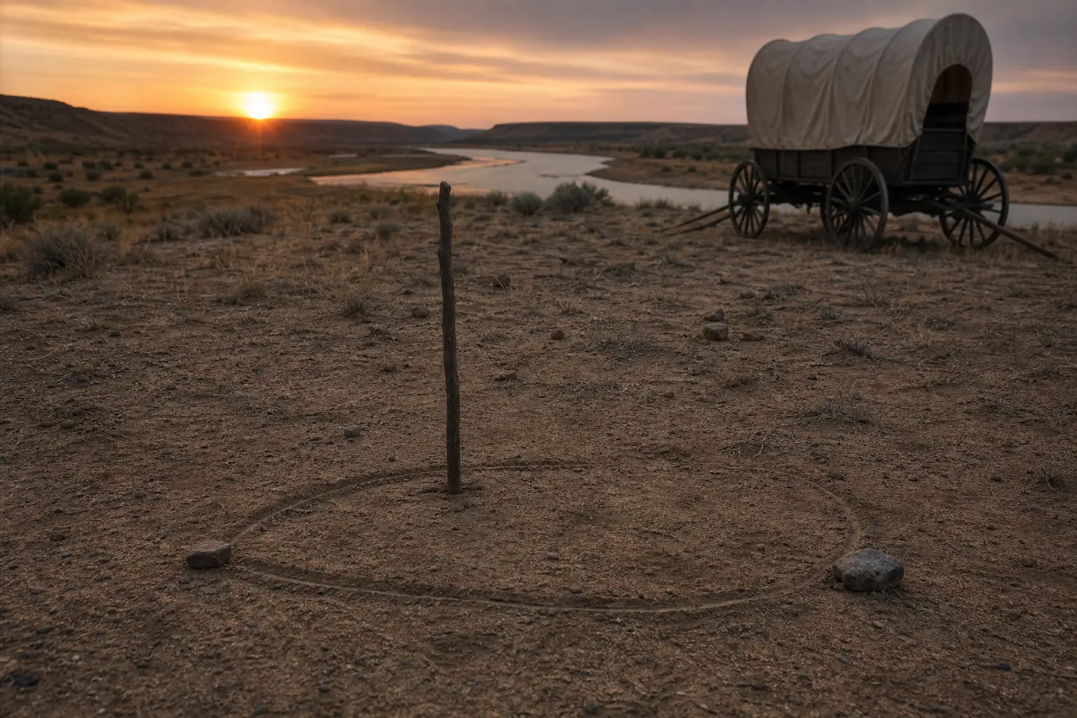
First, you do what you should have done yesterday. You find a straight stick, about three feet long. You push it into a flat, clear patch of ground. The sun is low enough to cast a long shadow. You find a small, sharp rock and place it directly on the tip of the shadow. That rock is west. You know this for a fact. It’s the first piece of solid ground you’ve stood on in two days.
You wait. The sun crawls down. The shadow of the stick pivots, growing longer. After fifteen minutes that feel like a year, you place another rock at the new tip of the shadow. That rock is east. You draw a line in the dirt between the two rocks. Now you have a compass drawn in dust. You stand with your left foot on the west rock and your right foot on the east rock. You are facing north. The trail, the real one, is somewhere in that direction. A vast, unforgiving direction, but a direction nonetheless.
Sam watches, his expression unreadable. “The sun moves,” he says, stating the obvious.
“The ground doesn’t,” you reply.
That night, the clouds roll in. There will be no North Star. You sit by the fire, listening to the coyotes. You think about Morrison’s last words, a fever-dream whisper about a river that “drinks the sky.” You feel a cold knot in your stomach. What if the river’s bend wasn’t a mistake? What if it’s a feature, a curve that will lead you back to the main trail if you just follow it? But which way?
The next morning is gray and overcast. Your sun compass is useless. You look at the trees along the riverbank. The old tale about moss growing on the north side of a tree is a lie you learned as a boy. Here, moss grows wherever the damp is.
You turn back to the river. It flows from the mountains to the plains. From high ground to low ground. You know the trail follows the Platte, and the Platte flows east. You check the line you drew yesterday. This tributary is flowing southeast. It has to join the main river eventually. You hope.
You make a decision. You’ll follow the water. It’s the only thing out here that isn’t lying. You tell Sam to yoke the oxen. Hannah kicks dirt over the fire without a word. As you climb onto the wagon seat, you see the sun break through a thin patch of clouds. It’s in the east, right where your dirt-and-rock compass said it would be. It’s not a promise, but it’s enough.
What Was Real
For the more than 400,000 people who traveled the Oregon, California, and Mormon Trails between the 1840s and 1860s, navigation was a matter of life and death. While some wagon trains employed experienced guides (mountain men who knew the routes intimately), many emigrants relied on a combination of rudimentary maps, guidebooks, and natural observation.
**Rivers as Highways:** The primary navigation tool for the first half of the journey was the Platte River. Its course, flowing eastward from the Rocky Mountains, provided a reliable handrail. Emigrants knew that as long as they were following the Platte west, they were generally on the right track. The Sweetwater, Snake, and Columbia rivers served similar roles in later stages of the journey. Getting lost often meant losing the river.
**Celestial Navigation:** The North Star (Polaris) was the most reliable celestial marker. On clear nights, it provided a constant, true-north bearing. During the day, the sun was the main guide. The “shadow compass” method-marking the tip of a stick’s shadow in the morning and again in the afternoon-was a simple and effective way to establish a true east-west line, and from there, north and south. This was far more reliable than simply guessing based on the sun’s position at noon, which varies with the season and longitude.
**Debunked Myths:** The popular notion that moss grows exclusively on the north side of trees is a dangerous oversimplification. Moss grows where conditions are cool and damp, which in the Northern Hemisphere is often the north side, but it’s not a reliable indicator for navigation. Similarly, relying on prevailing winds was risky, as local terrain could alter wind direction significantly.
**The Role of Guides:** A good guide was worth more than any piece of equipment. Men like Jim Bridger and Thomas Fitzpatrick knew the land, the safe river crossings, the locations of fresh springs, and the temperament of the native tribes. Losing a guide to illness or accident was a catastrophic event that could, and did, doom a wagon train.